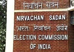
Election Commission of India in its constant endeavor to provide information and services to citizens in a hassle free manner has started a new service on the website of the Commission – www.eci.nic.in. Polling Station locations of National Capital Territory of Delhi and Himachal Pradesh have already been plotted on maps and can be seen by citizens when they visit the concerned page on the website of Election Commission of India. Polling Station locations of rest of the country are being plotted and will be available very soon on the website.
A tab named “Information Linked to Polling Station Maps” has been provided on the left hand side panel of the website of the Commission. Citizens can visit the Polling Stations Maps page by clicking on this tab. Once on the page, citizens will see the names of States for which maps of polling stations are available. On clicking on the name of the State, the map page will open up. Citizens can select District, Assembly Constituency and Polling Station names from drop down lists and click a button to see Polling Station Locations of the selected area on the map viewer on the page. It is possible to zoom into any point on the map to increase the magnification by either double clicking on the map or by increasing the magnification on the left side on the map viewer.
Users can activate the satellite image layer and even see the Polling Station buildings, and the roads leading to it. Polling Station Locations are seen as Pins dropped on the map for each Polling Station. On clicking on the Pin, a balloon opens up showing the names and cell phone numbers of the Chief Electoral Officer, District Election Officer, Electoral Registration Officer and Booth Level Officer.
There is also a link provided for Electoral Rolls. On clicking this link, Electoral Roll for that Polling Station opens up in PDF format and can be saved by the user on his local computer and also printed from the local computer. The Commission hopes that electors and political parties will find this facility useful for the smooth and active participation in the electoral process


